Google Earth upgrades to sharper images
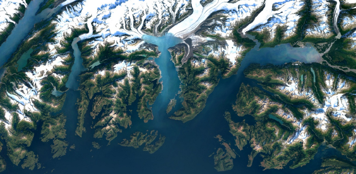
Google Earth images with 700 trillion pixels of cloud-less Landsat data – Colombia Glaciers (Alaska)
Google Earth will now deliver clearer and cloud-less maps with high-resolution imagery with its new technological makeover. However, representing Indian territories and international boundaries still remain at unease.
The free online mapping service from Google will now use images from US Landsat 8 satellite. This unique NASA (the US National Aeronautics and Space Administration) model reportedly captures twice as many images everyday than the previous one and is supposed to bring a 700-trillion pixel improvement to Google Earth maps. The cloud-less technology implemented in these images will allow users to have a much clearer view of remote places.
Mosaicking cartography technique
To get the most accurate images, Google uses cartography technique called mosaicking, which uses all historic images as well as current ones to create a median image of the area.
According to Chris Herwig, Program Manager, Google Earth Engine, working on the new upgrade rolled out on this Monday, Google Earth was using images from a Landsat 7 satellite, which encountered a hardware glitch in the recent times resulting in large diagonal gaps in pictures. However, images captured by Landsat 8 would be much better in detail, colour and frequency, he wrote in his blog.
“Like our previous mosaic, we mined data from nearly a petabyte (1015 bytes of data, 1,000 terabytes, or TB) of Landsat imagery—that’s more than 700 trillion individual pixels—to choose the best cloud-free pixels. To put that in perspective, 700 trillion pixels is 7,000 times more pixels than the estimated number of stars in the Milky Way Galaxy, or 70 times more pixels than the estimated number of galaxies in the Universe,” Herwig added.
The Landsat program, a joint program of the US Geological Survey and NASA, has observed our planet since 1972 and is an asset of information on the topographical changes of Earth over time.
India’s stringent map laws
Citing concerns over global terrorism threats and sensitive issues related to international boundaries, India had already expressed a strict regime (Geospatial Information Regulation Bill) for maps in the course of events over the last few months.
A series of controversies involving Twitter, Facebook and Google surfaced in May, when online maps showed Kashmir and other disputed areas as part of China or Pakistan. While land claims have already resulted in five wars in the history, India maintains its stand regarding the sensitivity of border issues. As per the new laws, any digital map of India will need a licence or approval from the government before it goes on air for public viewing.