
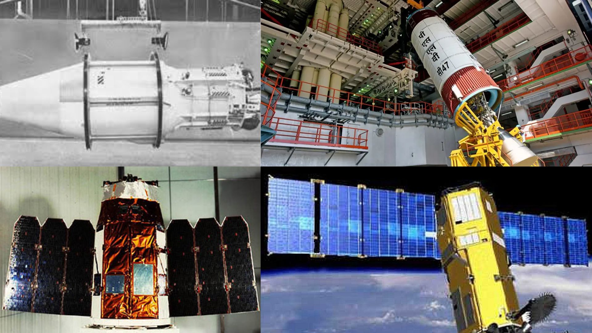
Military satellites are the unsung sentinels of the sky, artificial eyes orbiting Earth, silently supporting a wide range of defence operations.
Orbiting far above Earth, military satellites are the unsung sentinels of the sky, artificial eyes orbiting Earth, silently supporting a wide range of defence operations. From secure communication and navigation to intelligence gathering and high-resolution surveillance, these satellites are the backbone of 21st-century warfare and national security.
The story began in the mid-1950s, when the United States of America (USA) pioneered the development of military satellites. By the late 1950s, the first reconnaissance satellites were launched, focused primarily on photographic intelligence and early missile warning systems. In 1960, the U.S. Navy took a leap forward by deploying the world’s first navigation satellite, laying the groundwork for the GPS systems we rely on today.
Over time, military satellites evolved from basic reconnaissance tools into powerful imaging machines capable of capturing the aftermath of covert operations with astonishing clarity. These images not only assist in real-time strategy but also offer critical documentation of strikes, troop movement, and infrastructure damage.
Here are six military satellites renowned for their high-resolution imaging capabilities, silent but strategic players that shape the outcomes of global conflicts.
KH‑1, USA
Based on the Agena-A upper stage, the KH-1 (Keyhole-1) was the first in the Corona programme, a series of optical reconnaissance satellites of the United States. Built by Fairchild Camera Company, it carried a Satellite Return Vehicle (SRV) for film recovery and was designed to capture images of the Earth’s surface for intelligence purposes. The camera had a 61 cm focal length and an f/5.0 aperture, offering a ground resolution of 12.9 metres. The early missions were mostly test flights, Discoverer 1 launched without a camera or return capsule, while Discoverer 2 and 3 carried only the SRV. Eventually, ten KH-1 satellites were launched, but only one mission successfully returned film. Three failed to reach orbit, and the first eight missions couldn’t bring the capsule back. After that, Discoverer 12 and 13 were launched without imaging payloads to re-test systems. Finally, KH-1 9 marked the only successful return of film during the KH-1 series.
In contrast, decades later, KH-11 (Kennen) satellites demonstrated how far technology had come. In 2019, then-President Donald Trump tweeted a classified satellite image that was later confirmed to be from a KH-11. The image showed the aftermath of a failed Iranian missile launch and was later declassified through a FOIA request. The photo was so clear that many initially assumed it had been taken by a drone.
CartoSat Series, India
India houses its own set of military satellites with high-resolution imaging features, among them is the Cartosat series. The Cartosat series is a group of Indian Earth observation satellites developed by ISRO for high-resolution imaging and remote sensing. These satellites serve multiple purposes, including urban and rural planning, resource management, and defence applications.
They are placed in Sun-synchronous orbits, which means they pass over the same spot on Earth at the same local time every day, ideal for monitoring and comparison. The Cartosat-2 series in particular provides sub-metre resolution, with some versions capable of imaging objects smaller than 1 metre. They carry advanced cameras that capture both panchromatic (black and white) and multispectral (colour) data. The satellites can steer their cameras up to ±45 degrees along and across the track, making it possible to image specific targets and enabling quicker global coverage.
First launched in 2005, Cartosat imagery has been used in key military operations. In 2016, the Indian Army reportedly used it during the surgical strikes. Later, it was reportedly used during the recent conflict with Pakistan, Cartosat and other satellites were used to track troop movements and monitor border activity. In 2020, Cartosat-2F was used to avoid a potential collision with a Russian satellite, showcasing its growing strategic relevance in both defence and space management.
Ofeq Series, Israel
In 1988, Israel launched its own military satellite, equipped with high-resolution imaging, the Ofeq series. Used primarily for military surveillance, the Ofeq, horizon satellites form a reconnaissance fleet designed to monitor regional threats. They are typically launched using the Shavit rocket from Palmachim Airbase, into a retrograde orbit, a unique approach where the satellite travels opposite to Earth’s rotation.
This westward launch over the Mediterranean Sea is a strategic choice to avoid passing over populated areas during ascent, given Israel’s geographic constraints.
Despite the unusual orbit, the Ofeq satellites are equipped with powerful optical payloads and, in later models, Synthetic Aperture Radar (SAR) systems, capable of delivering sub-metre resolution, according to the International Journal of Innovative Research in Science, Engineering and Technology.
The imagery and data from these satellites are used by Unit 9900, the Israeli military’s elite visual intelligence division, to support operational planning, threat detection, and real-time decision-making. In essence, Ofeq satellites act as an early warning system, keeping constant watch over Israel’s neighbourhood and providing critical intelligence to ground commanders.
Kompsat-5, South Korea
In East Asia, South Korea launched its first radar satellite, Kompsat-5, in 2013, marking a major step in its space-based surveillance capabilities.
Commonly known as Arirang-5, the satellite is part of the Korean National Development Plan and is operated by the Korea Aerospace Research Institute (KARI).
Its primary mission is to provide all-weather, day-and-night Earth observation using Synthetic Aperture Radar (SAR) technology. It is equipped with multiple imaging modes offering different combinations of resolution and swath width, from 1-metre resolution with a 5 km swath in high-resolution mode, to 3 metres at 30 km in standard mode, and 20 metres at 100 km in wide swath mode. It can also capture images in multiple polarisation formats including HH, HV, VH, and VV, allowing greater flexibility for various observation requirements.
Though originally planned for a five-year mission, the satellite outperformed expectations, and its operations were extended well beyond 2018, becoming a vital tool for South Korea’s strategic monitoring, environmental analysis, and military reconnaissance.
Razdan, Russia
In Russia, the Razdan N satellite stands as the next-generation successor to the earlier Persona (Kvarts) reconnaissance satellites.
A high-end electro-optical spy satellite, Razdan is equipped with advanced upgrades, including a secure high-speed radio communication channel and a sophisticated optical system developed by LOMO, one of Russia’s leading optics manufacturers.
Designed primarily for observing ground-based optical calibration targets, Razdan significantly enhances Russia’s surveillance capabilities. At its core is a large 2.4-metre primary mirror, a major leap from its predecessors, enabling far sharper imaging.
With an estimated ground resolution of 20 to 30 centimetres per pixel, Razdan can capture highly detailed images, sharp enough to detect and monitor military equipment, even when it is concealed under camouflage.
Its precision places it in the league of elite imaging satellites, offering Russia a sharper eye in space for real-time intelligence and strategic surveillance.
HY2, China
Ending the list is a satellite series focussed not on land, but on the vast and shifting dynamics of the sea, the HY-2 satellite, part of China’s marine dynamic environment observation programme.
Operated by the China National Space Administration (CNSA), HY-2 is a second-generation ocean observation satellite designed to monitor marine environmental trends using advanced microwave sensors. Its main objectives include measuring sea surface wind, sea surface height, wave height, and sea surface temperature, providing critical data for understanding oceanic conditions and their impact on regional climates.
First launched in 2011, the inaugural HY-2 satellite served as a technology demonstrator and laid the foundation for continuous ocean surveillance. The satellite operates across five different microwave frequency channels, ranging from 6.6 GHz to 37 GHz, and offers a swath width of 1600 km.
Ground resolution varies with frequency, from 100 km at the lowest frequency to 18 km at the highest, allowing it to capture both broad-scale and more detailed observations of the sea. HY-2’s precise readings support not just scientific research, but also naval operations, maritime safety, and disaster response, giving China a powerful eye over its maritime interests.
Together, these six satellites, from America’s early KH-1 to China’s ocean-focussed HY-2, demonstrate how nations are investing in space-based intelligence to monitor not just their borders, but the broader strategic theatre. Whether scanning deserts, forests, or oceans, each system reflects a unique blend of geopolitical needs and technological ambition. In an increasingly contested global landscape, the real-time imagery and data these satellites provide are more than just pixels, they are power.
