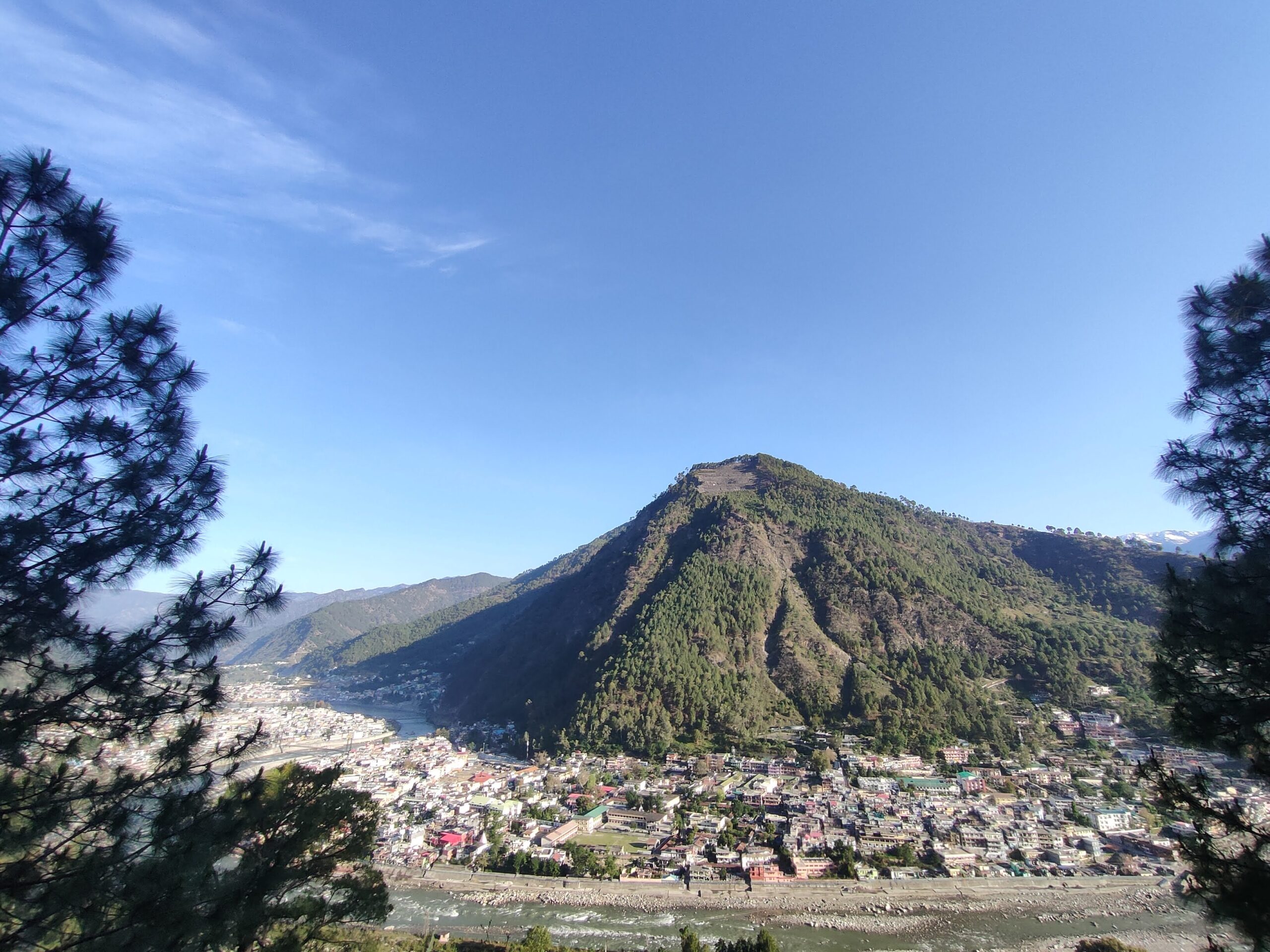
Uttarkashi: Umbrage of the Varunavat Parvat over the entire town
Tucked away in the creases of the Himalayan mountains, the hilly district of Uttarkashi, on border with Tibet, marks the northern boundary of Uttarakhand. Though known mainly for its Gangotri and Yamunotri treks, Uttarkashi has plenty of other attractions.
The district headquarters, an eponymous bustling town of 40,000, is the last big inhabitation for pilgrims headed to the holy sites of Gangotri and Yamunotri temples, parts of the Char Dhaam pilgrimages that devout Hindus are expected to do at least once in their life.
At an altitude of 1165 m, it also serves as a base camp for the adventure seekers who head out on the treks that start from the two temples.
Uttarkashi enjoys warm and wet summers when the early hours of noon are usually pleasant, although the Monsoons sometimes terrorise the area and caused heavy destruction, as in 2012 and 2013. The area is nevertheless loaded with scenic beauty during the rains. The winters are usually harsh. Places at higher altitudes usually remain covered with snow throughout the winters.
Spanning over 8,000 sqkm, Uttarkashi is home to many fascinating spots and tourist destinations.
Harsil
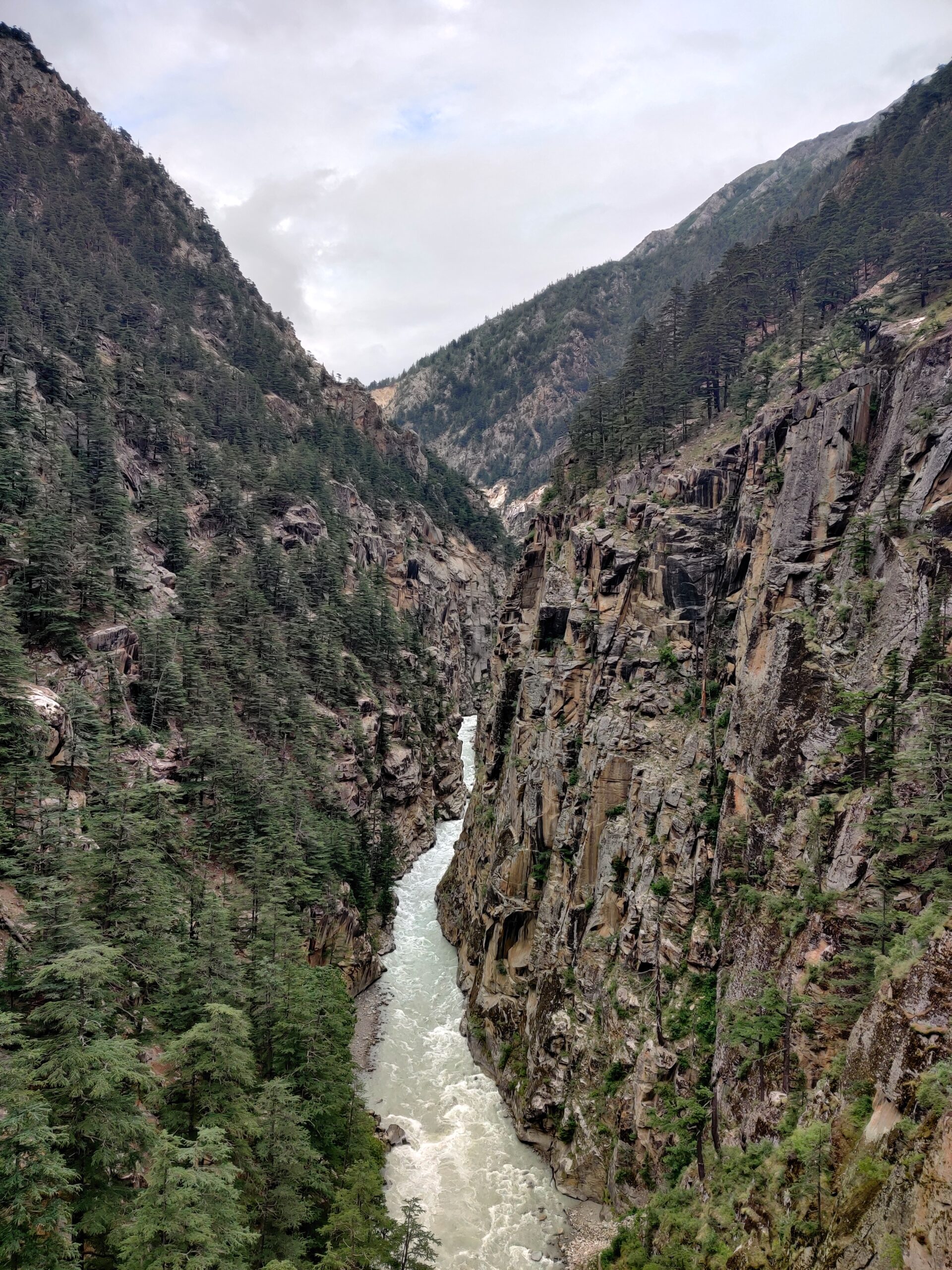
From the high altitude bridge
Sometimes referred to as the mini Switzerland of India, Harsil is a small village on the banks of the River Bhagirathi and is surrounded by mountains on two sides. The Harsil valley lies on the Uttarkashi-Gangotri road, almost 70 km from the main town and is very close to Gangotri dham. The valley also features a bridge at Bhaironghati, which is one of the highest bridges in Asia.
Proximity to Gangotri also makes it a popular tourist location for devotees and enthusiasts trekking to Gaumukh where the River Ganga originates from Gangotri glacier. After the portals of the dham are closed at the onset of winters, the idol of Goddess Ganga is brought down to the Mukhwa village in Harsil valley.
The valley is also home to many apple orchards, sprinkled across all the villages. One of the most famous varieties of the fruit, Wilson apples, was brought here about 160 years ago by the Englishman Fredrick Wilson, who had deserted the British army to come and live in the Garhwal hills.
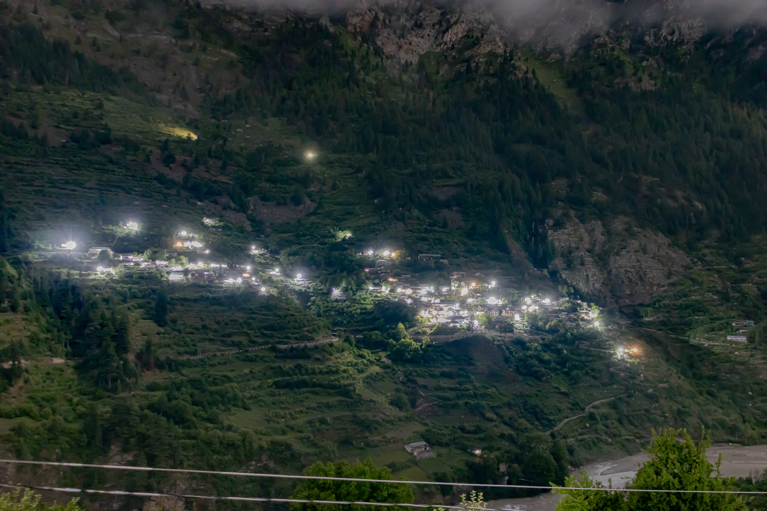
Dharali in the laps of Harsil valley
The summers in the valley are pleasant but it snows throughout the winter season. It is adorned by Harsil Horns, a pair of two mountain peaks that look like horns of an animal. This year in June, the Horns were scaled by an expedition team from the Nehru Institute of Mountaineering, which is also located in Uttarkashi, for the first time ever.
Dharali is another village in the valley. A short trek of 4 km from this village takes one to Sat-tal (seven lakes) area. However, only four lakes are visible as two have dried up, while the 7th lake remains untraceable.
During the Sino-Indian war of 1962, Tibetan migrants swarmed in the valley in large numbers and have today settled in the Badori village in the valley.
Chaurangi
After a short ride on the Uttarkashi-Lambgaon motor road, one reaches the small village of Chaurangi. The small shops on the road serve delightful, hot stuffed paranthas (Indian bread), topped with butter. The village has a beautiful temple dedicated to Chaurangi Nath devta and represents the quintessential Garhwal architecture. The red-painted roofs sloping downward stand in stark contrast to the white walls of the temple. The threshold to the temple has a carved wooden door.
The motor road also hosts a Maggie Point, which is the abode of travellers throughout the year. A cup of tea and a bowl of Maggie noodles with a view of the Varunavat Parvat satisfies the soul and the stomach equally after a ride on the curvy roads. A 15-20 minutes trek upward from here leads to meadows that provide a breathtaking view of the hill-tops of the town.
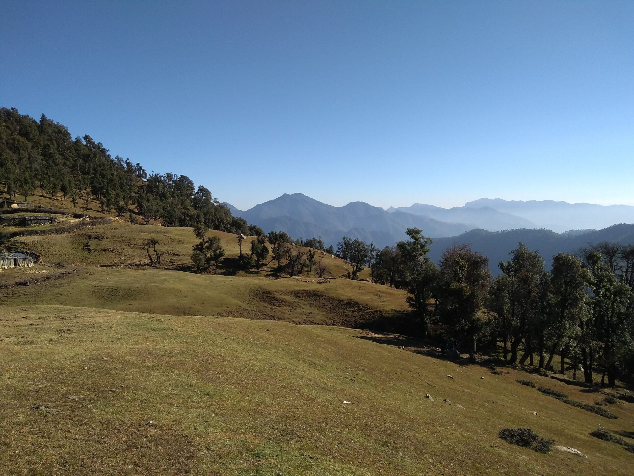
The wide stretch of meadows above the Chaurangi road
A short 3-4 km trek from the temple leads to Nachiketa Tal, a lake which holds fascinating views for the travellers. A temple dedicated to Nachiketa is situated near the lake.
Dodital
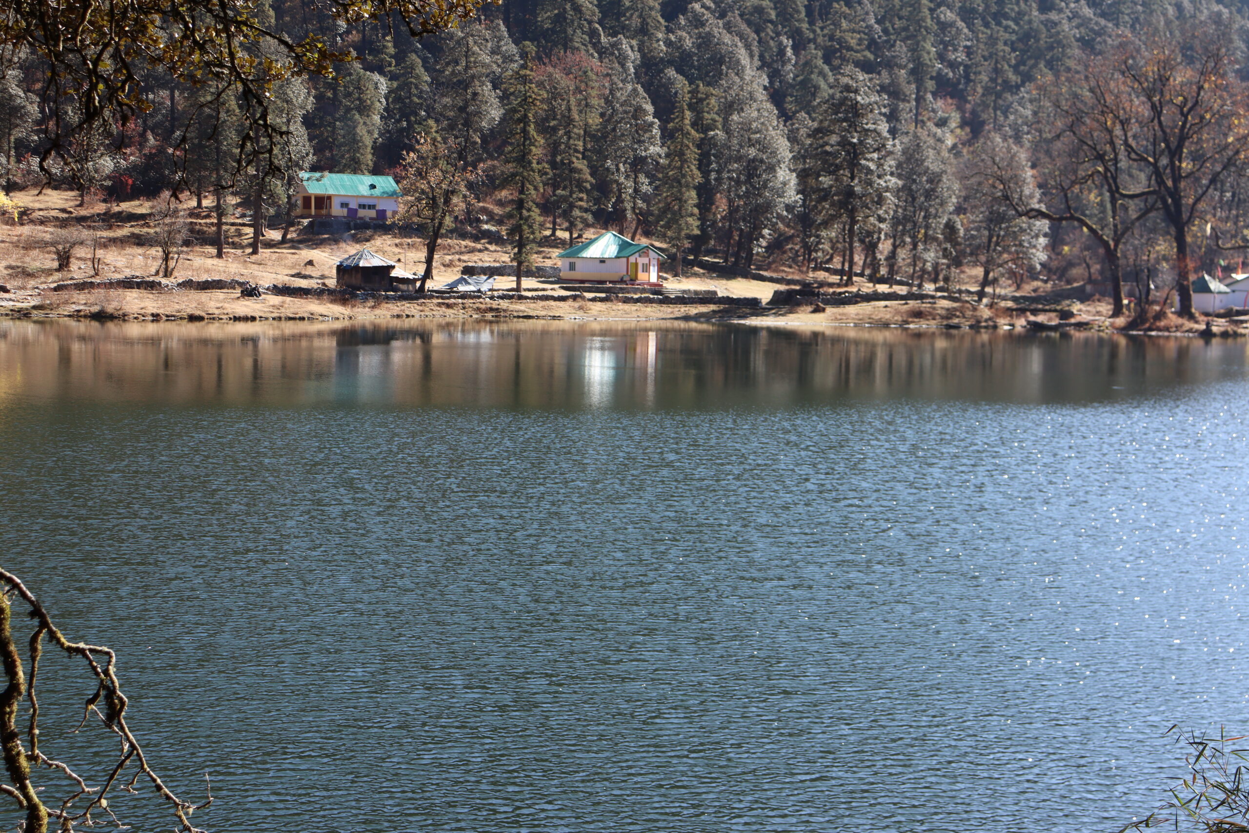
Dodital Lake
Dodital is a freshwater lake at an altitude of around 3000 m. The place also finds its mention in mythology as the birthplace of Parvati’s child as the elephant-head or Ganesha. A temple dedicated to Lord Ganesha stands near the lake.
Vehicles run from the main town till the Aghora village. The trek starts from Aghora. The first settlement called Manjhi village comes after a long tread of over 8 km. People usually continue the remaining leg of the trek the next day as the place is home to tigers and bears and is considered unsafe after sunset. The next day, the distance from Manjhi to Dodital can be covered within 4-5 hours. One can hire a mule to carry baggage. The really adventurous ones can go the extra mile (meaning an extra day) and reach Darwa Top, a pass at 4150 m that offers beautiful views of numerous Himalayan peaks, notably Banderpoonch and Kala Nag.
Camping at Dodital Lake provides a view of the Milky Way galaxy at night, often accompanied with furious winds.
NIM

The Nehru Institute of Mountaineering campus
Nehru Institute of Mountaineering is one of the most prestigious mountaineering institutes in Asia. The first Prime Minister of India was an ardent lover of mountains and the institute was set up on November 14, 1965 under the aegis of the Ministry of Defence and the then Government of Uttar Pradesh. The institute leads expeditions to Mt Everest every year. The first Indian woman to scale the peak, Bachendri Pal, was also trained here.
NIM lies a few kilometres above the Ladari village and is accessible by road. The well-maintained campus spans the Ladari Reserve Forest and is surrounded by pine trees. The campus stretches over seven hectares of land and houses all the modern mountaineering gadgets and several climbing walls. The Institute facilitates various courses in mountaineering like Basic, Advance, skiing, etc. The NIM museum is filled with visitors throughout the year and is adjacent to Cafe Himalaya which serves snacks. A bust of Nehru stands erect a few metres from the Cafe.
Mahidanda
A battalion of the Indo-Tibetan Border Police resides in Mahidanda. A few kilometres above the army post lies the Varunavat Parvat, which provides a breathtaking view of the entire town. On the way up the hill, the River Bhagirathi (one of the two main headstreams of the Ganges) flows along the roads carved in the hills.
Varunavat faced a massive landslide in 2003 when the entire summit of the hill came down due to rains. Adjacent portion of the main market was also reduced to debris. After the treatment work was carried out, the top portion of the hill attracts the youth of the town as a popular spot to hang out.